


Get the altitude and coordinates of your current location instantly! No more frustration with the contour lines on topographical maps.
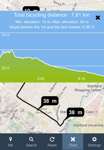
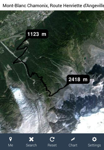
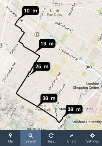
The Altitude Profile displays the elevation in meters or feet and creates an elevation profile chart for the selected locations anywhere on Earth, e.i. also for the underwater terrain. You can to mark up to 50 points on the map to draw the elevation profile chart.
The Altitude Profile is a wonderful tool for many outdoor activities, such as hiking, cycling, skiing etc. The elevation profile chart helps to plan and review your tours and estimate the difficulty of your track.
The basic application features such as finding your current location and altitude do not require an internet connection. The Altitude Profile therefore uses the GPS tracking technology on your iPhone. It enables to use the app anywhere outdoor and it works in places where no mobile data network is available.
To be able to obtain the location and elevation data for any other than your current location, an internet connection is needed. The Altitude Profile uses the Google Maps API services to geolocate the selected locations and to mark the those locations on the map.